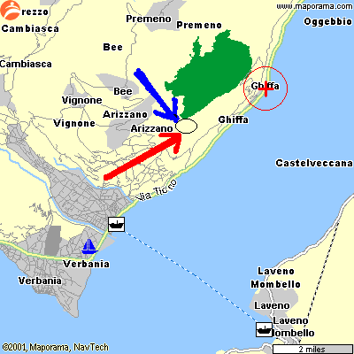
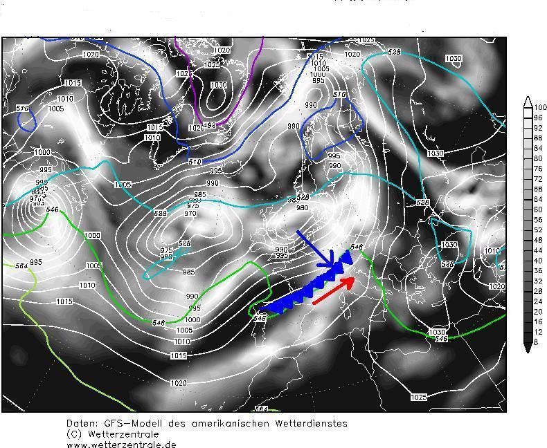
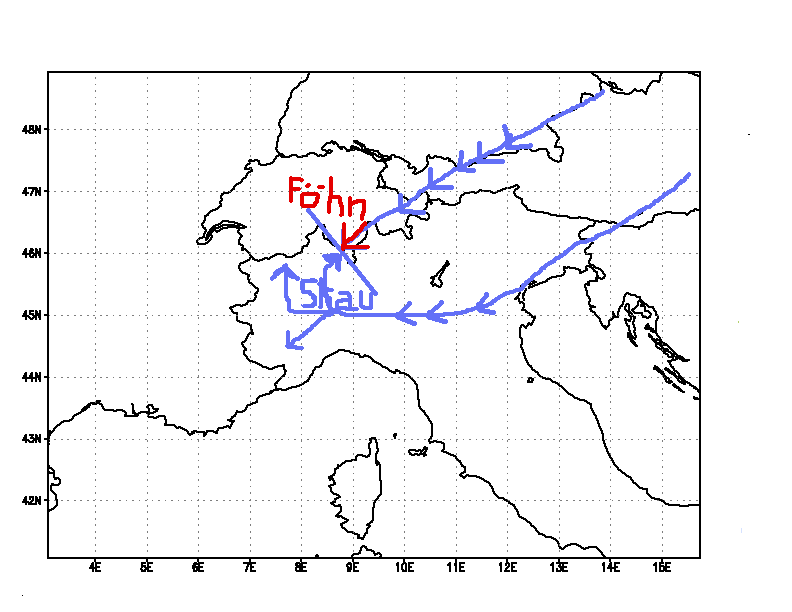
The red arrow shows the valley breeze, the blue one shows the mountain breeze.
THIS DESCRIPTION IS
WRITTEN BY A NOT-PROFESSIONAL METEOROLOGIST.
MAY BE THE ENGLISH GRAMMAR AND THE METEO ANALYSIS ARE NOT COMPLETELY CORRECT.
IF YOU HAVE ANY SUGGESTIONS OR CORRECTIONS TO PROPOSE, PLEASE WRITE
HERE
The
not-professional meteo station of Ghiffa
(latitude=45°57'11"N; longitude
8°35'55"E)
is
located on the hills surrounding the Lake Maggiore, 400 mt.above the sea level,
about 200 mt over the Lake level, between the Borromean Gulf at SW and the
Northern part of the Lake, in direction of the Swiss border.
In good
weather conditions, during the day it receives the valley breeze from SW (Po
plain) and during the night the mountain breeze from NW.
The red arrow shows the valley breeze,
the blue one shows the mountain breeze.
Influence of the Lake on the temperatures
The lake reduces the daily and yearly thermic excursions.
During the winter, the snow level is higher on the mountains surrounding the
Lake.
Stau and foehn
These are two opposite
phenomens occurring when a air mass is compelled to cross a mountain chain.
The Stau (in German=obsctruction) occurs when an air mass is going up a mountain chain. During the upward
movement it expands, it becomes colder, causing the steam to condense, forming
clouds and releasing the latent warm.
Before the condensation the temperature decreases about 1°C/100 meters.
When the steam begins to condensate, the temperature decreases only
0,6°C/100 meters.
The Foehn occurs when an air
mass is going down a mountain chain. Falling downward it becomes warmer owing to
the compression, causing
the steam to evaporate. The temperature increase is about 1°C/100 mt.
So, at the same altitude, the temperature is higher in the mountain side where
the foehn occurs.
In our zone the foehn comes from North; the air is originally cold; during the
foehn effect, the temperature can rise up to 20°C in winter; in the same day, if
the wind stops, the air reassumes quickly its nature of cold air,
causing the temperature decrease below 0°C.
Paradox:
During the Stau (with
southern and eastern winds in our zone) the pressure increases due to air accumulation,but it
rains.
At the beginning of the
foehn, the air pressure is very low but the weather is clear.
So, authomatic weather stations showing the sun icon when the pressure increases
and showing cloud and rain icon when the pressure is falling, in this zone make
often mistakes.
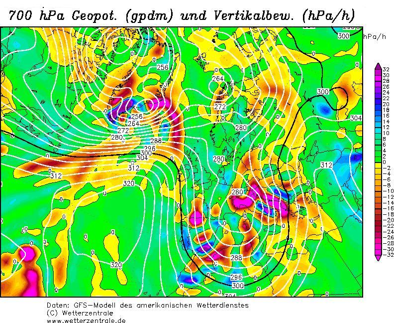
Fronts coming from West or South-West
These
fronts rebuild themselves immediately at East of the French-Italian border giving
rain in our zone (see the picture below), if the Southern end of the depressure
axis stands
more Southern than the end of the French Alps
(Principaute
de Monaco).
If the
Southern end of
the depressure axis stands more
Northern than the end of French Alps (Principaute
de Monaco),
in autumn, winter, spring (for summer climate read below)
no rain is expected here.
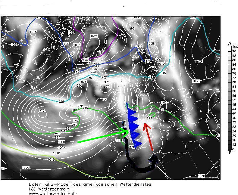
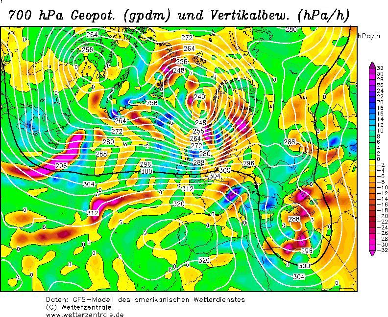
Fronts coming from North-West
In
Winter, Spring and Autumn (for summer climate read below), these fronts are blocked by the French-Italian Alps,
rebuilding themselves at South-East of our zone, which doesn't receive rain. A very low
pressure zone is generated on our zone,with clear weather (paradoxe). In the
opposite Alp side the
Stau
occurs, and the pressure increases with bad weather (paradox). When the pressure
difference between the two sides becomes too high, the
depression in our zone is filled by violent foehn winds.
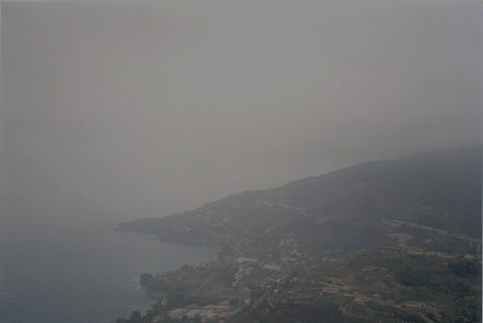
20/03/04: Pic of the French-Italian
border of Ventimiglia, where the Alps reach the Tirrenian Sea, with a
front coming from NW.
Fronts coming from North-West stop here (where it rains) and rebuild themselves
more Eastern, leaving Italian North-West dry.
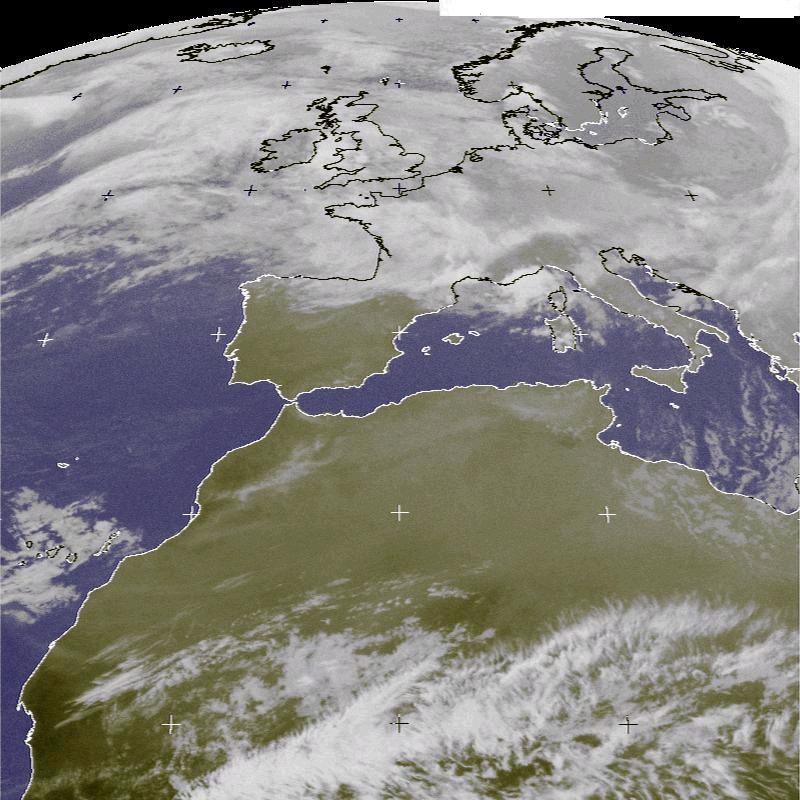
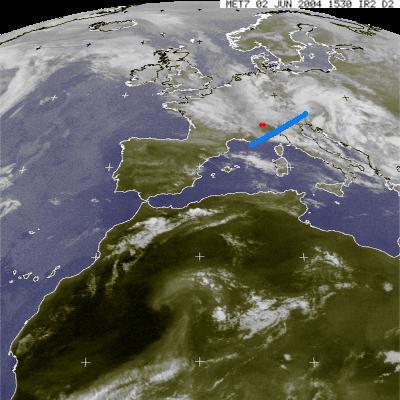
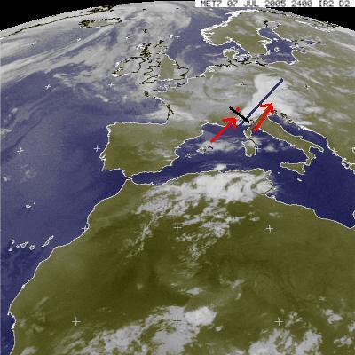
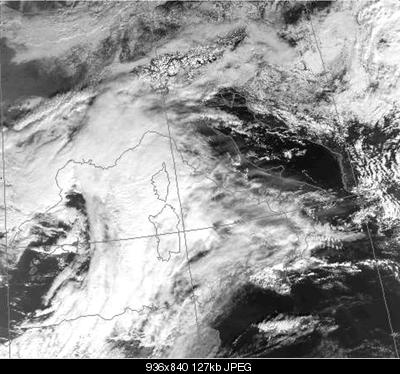
In summer
the contrast between warm-humid-soil and cold-dry air in upper layers
produces strong thunderstorms when these fronts come . In this satellite
pic here below, taken on June 2nd,2004 and 08/07/05, it's possible to see the main
front (blue line) South Easth from our zone (red spot).
However mighty thunderstorms occurred. In the same situation, in
cold season, no rain would have fallen here.
THE EASTERN COLD WINDS
coming from East or North East from
Russia, enter the Po plain from the Gulf of Venice and come here from South,
following the valley of the Ticino river and the Southern Lake Maggiore. This
wind's local name is inverna.
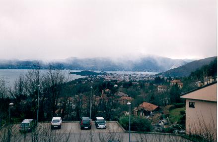
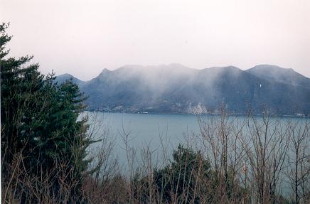
In the mountain near the Swiss border the same winds come directly from North-East after
having crossed the Alps (see the pic below).
On January 6th,2003 here the sky was cloudy with snow *virgas (see the pics
below); 20 Km Northern the weather was clear with strong foehn wind.
06/03/2003:
Satellite pic, kindly sent to me by Mr. Pierluigi Randi
Meteo Romagna
*Virgas are rain or
snowfalls in dry air, evaporating before reaching the soil.
In dry air with dew point below zero degrees, the snowflakes can still be
present at lower quotes
with temperatures above zero degrees, because they evaporate slowly.
In wet air the snowflakes become raindrops
at lower quotes with temperatures above zero degrees.
CLIMATOLOGICAL NOTE
Since about ten years
the classical
summer Azzorres anticyclone
(see the map below of July,29, 1947)
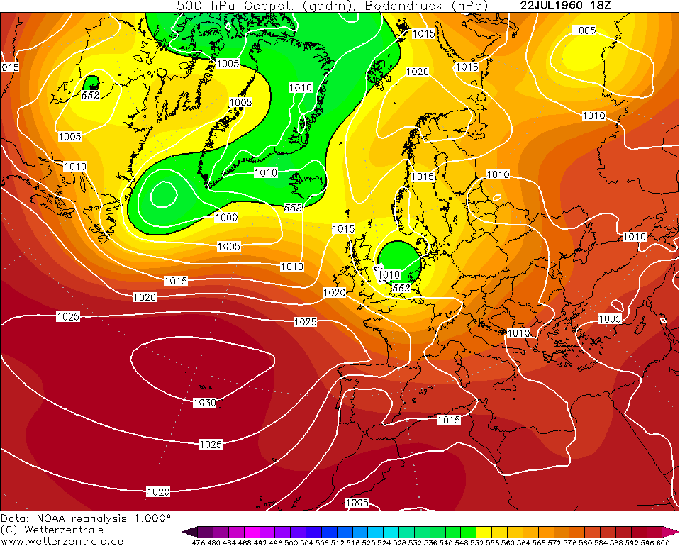
is replaced by a warmer and dryer North African
blocking anticyclone (see the map
below of 18 June 2005), which stands long time
in the same position.
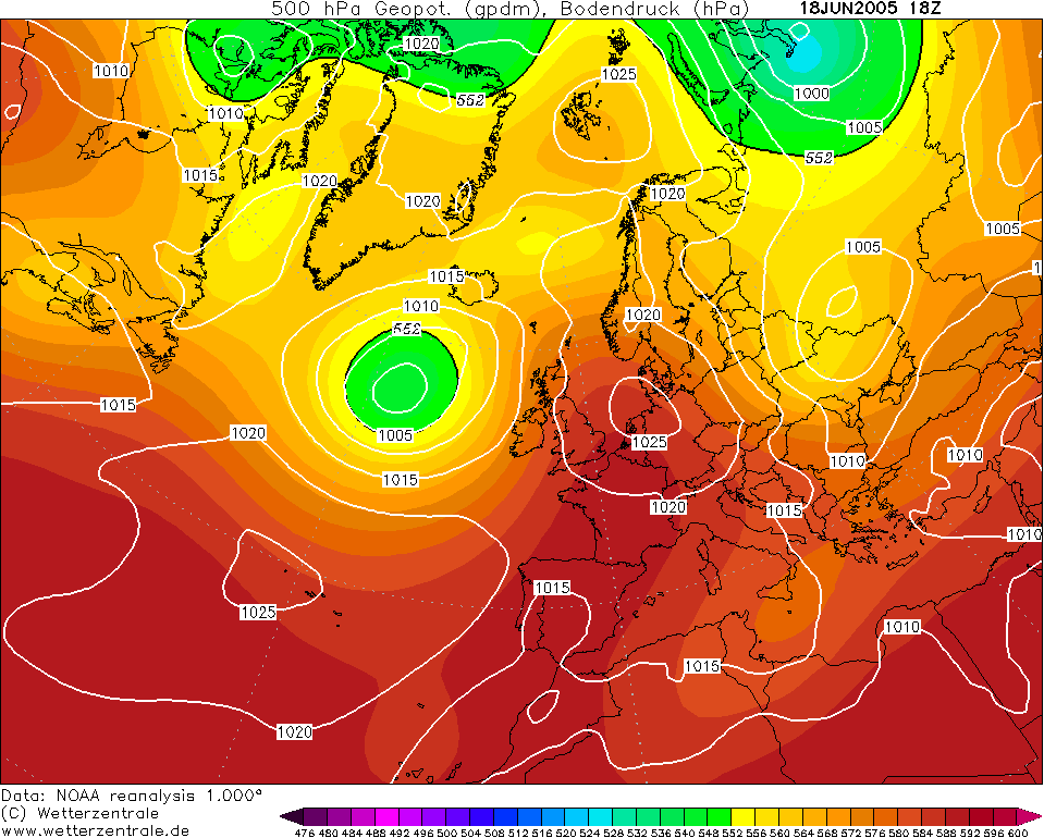
In winter the Azzorres anticyclone, instead of going
at lower latitudes, keeps the position
previously kept in summer, causing winter drought.
(See the map below of 24 January 2005).
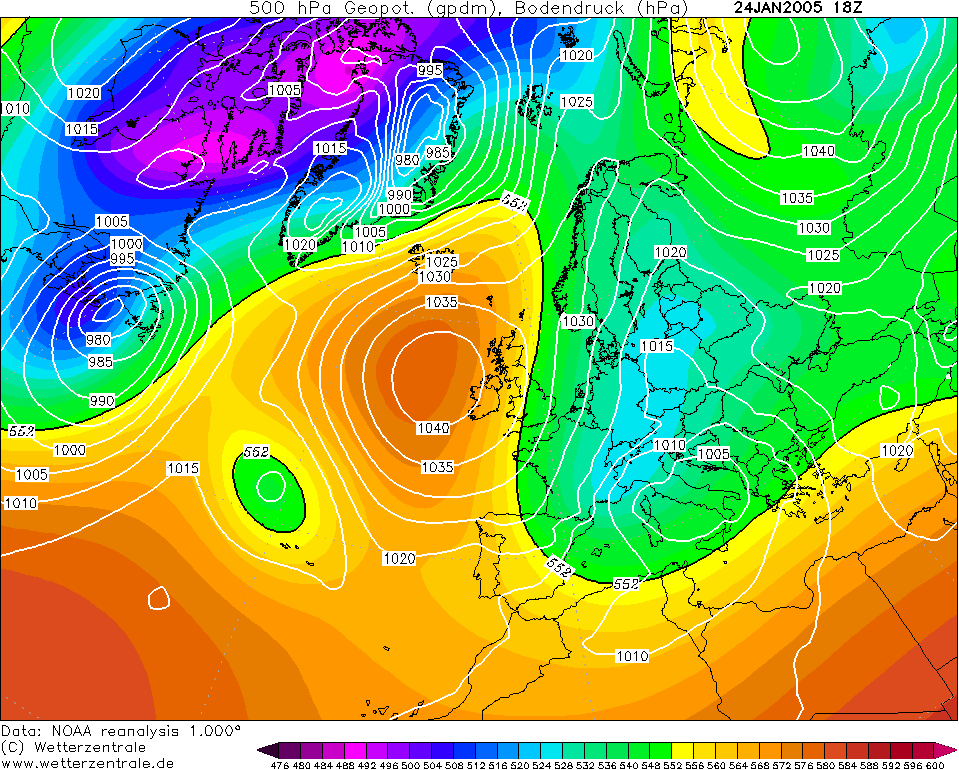
The reasons of the changes are still unknown.
Greenhouse gases(??),
a normal climate cycle (??),
more energy from the sun (??)
![]()
![]()
![]()
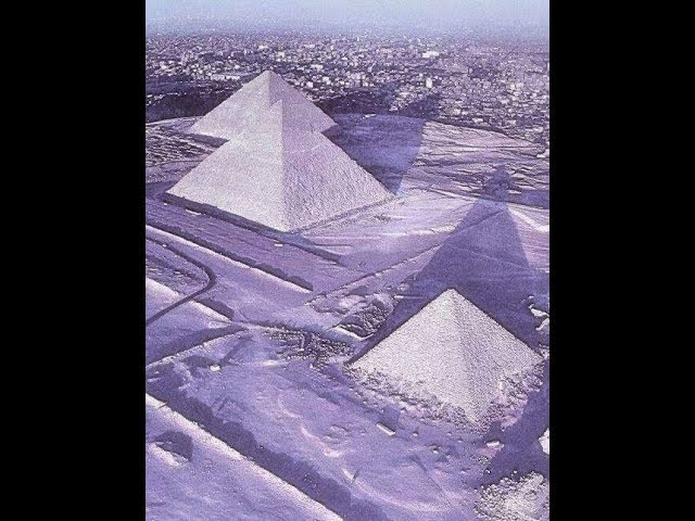
After 10 years
the scientific
magazine FOCUS
issued on March 2015
confirms my previous impressions.