![]()
Home page
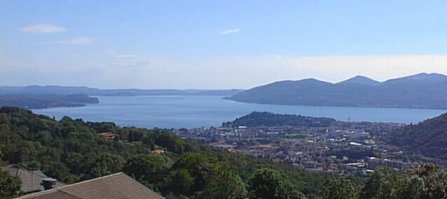
STAZIONE METEO
AMATORIALE DI
CEREDO DI GHIFFA
(VB)
MT. 394 S.L.M.
Lat:
45°57'16.7198" N
Long:
8°36'05.4141" E
INDICE
PAGINA
METEO
Previsioni
e rilevazioni
meteorologiche
Weather
forecast
Osservazioni e
grafici in tempo
reale
FUORI SERVIZIO
Plotting of the
main meteo
parameters
OUT OF ORDER
Rilevazioni
giornaliere
mensili ed annuali
2000-2007
Descrizione microclima
Daily measurements
and description of
the local climate
Immagini dal
satellite
Satellite pics
Radar
Per seguire
intensitŕ e direzione
delle precipitazioni
Monitoring
rainrate and movement
of the rainfalls.
Webcams
Carte
previsioni
Wetterzentrale
Wetterzentrale
maps
Carte Meteonetwork
MNW maps
Carte previsioni
fronti
Front forecast
maps
Westwind
Elenco europeo
di mappe
con animazione
Complete list
of European weather
maps with animation
Carte previsioni FNMOC
FNMOC maps
Carte sovrapposte
all'immagine
satellitare
Meteo maps
over the sat pics
Radiosondaggi
Radiosoundings
Scienze
naturali
+monitoraggio livello
e
temperatura del
Lago
Maggiore
Monitoring the
level and the
temperature of the
Lake Maggiore
Temperature marine
copertura glaciale e nevosa
Worldwide sea
temperature-
Ice & snow surface
Archivi Wetterzentrale
Archives of
Wetterzentrale
Didattica
Meteo lessons
![]()
Home page
Meteo Ghiffa
![]()
Forum
MeteoNetwork
![]()
![]()
![]()
Comune di Ghiffa
![]()
![]()
![]()


![]()

Portale dell'
Alpe Veglia


Unione velica Maccagno

Flotta Meteor
del Verbano

Porto Regionale
di Locarno

Infoverbania